kategoria
podkategoria
2021
-
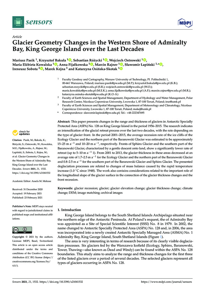
Pasik M., K. Bakuła, S. Różycki, W. Ostrowski, M. E. Kowalska, A. Fijałkowska, M. Rajner, S. Łapiński, I. Sobota, M. Kejna i K. Osińska–Skotak. „Glacier geometry changes in the Western Shore of Admiralty Bay, King George Island over the last decades”. Sensors 21 (4).
- [bib]
@article{2021_pasik_glaciers_aspa_sensors,
}title = {Glacier geometry changes in the Western Shore of Admiralty Bay, King George Island over the last decades}, author = {Pasik, Mariusz and Bakuła, Krzysztof and Różycki, Sebastian and Ostrowski, Wojciech and Kowalska, Maria Elżbieta and Fijałkowska, Anna and Rajner, Marcin and Łapiński, Sławomir and Sobota, Ireneusz and Kejna, Marek and Osińska–Skotak, Katarzyna}, journal = {Sensors}, year = {2021}, volume = {21}, number = {4}, issn = {1424-8220}, doi = {10.3390/s21041532}, - [streszczenie]
This paper presents changes in the range and thickness of glaciers in Antarctic Specially Protected Area (ASPA) No. 128 on King George Island in the period 1956–2015. The research indicates an intensification of the glacial retreat process over the last two decades, with the rate depending on the type of glacier front. In the period 2001–2015, the average recession rate of the ice cliffs of the Ecology Glacier and the northern part of the Baranowski Glacier was estimated to be approximately 15–25 m a−1 and 10–20 m a−1, respectively. Fronts of Sphinx Glacier and the southern part of the Baranowski Glacier, characterized by a gentle descent onto land, show a significantly lower rate of retreat (up to 5–10 m a−1). From 2001 to 2013, the glacier thickness in these areas decreased at an average rate of 1.7–2.5 m a−1 for the Ecology Glacier and the northern part of the Baranowski Glacier and 0.8–2.5 m a−1 for the southern part of the Baranowski Glacier and Sphinx Glacier. The presented deglaciation processes are related to changes of mass balance caused by the rapid temperature increase (1.0 °C since 1948). The work also contains considerations related to the important role of the longitudinal slope of the glacier surface in the connection of the glacier thickness changes and the front recession.
- [.pdf]
- [doi]
- [url]
- [bib]
2020
-
jcrScherneck H.-G., M. Rajner i A. Engfeldt. „Superconducting gravimeter and seismometer shedding light on FG5’s offsets, drifts and noise: What observations at Onsala Space Observatory can tell us”. Journal of Geodesy 94 (9).
- [bib]
@article{2019hgsmraejog,
}author = {Scherneck, Hans-Georg and Rajner, Marcin and Engfeldt, Andreas}, title = {Superconducting gravimeter and seismometer shedding light on FG5’s offsets, drifts and noise: What observations at Onsala Space Observatory can tell us}, year = {2020}, date = {2020-08-08}, month = {aug}, volume = {94}, issue = {9}, journal = {Journal of Geodesy}, doi = {10.1007/s00190-020-01409-0}, publisher = {Springer}, - [.pdf]
- [doi]
- [bib]
-
jcrTercjak M., A. Gebauer, M. Rajner, A. Brzeziński i K. U. Schreiber. „On the influence of diurnal and subdiurnal signals in the normal vector on large Ring Laser Gyroscope observations”. Pure and Applied Geophysics 177: 4217–28.
- [bib]
@article{2019tercjak_rlg_pageo,
}title = {On the influence of diurnal and subdiurnal signals in the normal vector on large Ring Laser Gyroscope observations}, author = {Tercjak, Monika and Gebauer, André and Rajner, Marcin and Brzeziński, Aleksander and Schreiber, Karl Ulrich}, journal = {Pure and Applied Geophysics}, year = {2020}, doi = {10.1007/s00024-020-02484-2}, volume = {177}, pages = {4217–4228}, publisher = {Springer}, month = {may}, - [.pdf]
- [doi]
- [url]
- [bib]
2019
-
Scherneck H.-G. i M. Rajner. „Using a Superconducting Gravimeter in Support of Absolute Gravity Campaining — A feasibility study”. Geophysica 54 (1): 117–35.
- [bib]
@article{2018_Scherneck,
}title = {Using a Superconducting Gravimeter in Support of Absolute Gravity Campaining — A feasibility study}, author = {Scherneck, Hans-Georg and Rajner, Marcin}, journal = {Geophysica}, year = {2019}, month = {apr}, pages = {117-135}, volume = {54}, issue = {1}, eid = {2-s2.0-85074660103}, - [.pdf]
- [preprintdoi]
- [bib]
2018
-
jcrRajner M. „Detection of ice mass variation using gnss measurements at Svalbard”. Journal of Geodynamics 121: 20–25.
- [bib]
@article{Rajner17svalbard,
}author = {Rajner, Marcin}, title = {Detection of ice mass variation using gnss measurements at Svalbard}, journal = {Journal of Geodynamics}, year = {2018}, month = {nov}, pages = {20-25}, volume = {121}, doi = {10.1016/j.jog.2018.06.001}, issn = {0264-3707}, - [streszczenie]
We compare observed uplift rates of Global Navigation Satellite Systems (gnss) with geophysical predictions at sites located on Spitsbergen. We show here that using modern postglacial rebound models, realistic mass balance for Present Day Ice Melting (pdim) and taking the deglaciation of the Little Ice Age (lia) into account, we can close the overall uplift budget at a level of a few millimetres per year. For this study we used gnss data from well-established geodetic sites in Ny-Ålesund and the new data from Hornsund. The significant increase of uplift rates since the beginning of 2011 was observed at both gnss sites. These height changes are attributed to recent increased ice mass loss of 6.0 Gt yr−1 for Svalbard. The total mass loss is estimated at 14.7 Gt yr−1. Ice unloading caused also a noticeable increase of distance between Ny-Ålesund and Hornsund. We show that the specific location of the two sites facilitates inference of differential mass loss within the Svalbard Archipelago.
- [doi]
- [url]
- [bib]
2017
-
Wilde-Piórko M., P. Dykowski, M. Polkowski, T. Olszak, M. Grad, J. Kryński, M. Sękowski, A. Krankowski i M. Rajner. „Expanding seismic surface waves measurements towards low periods with gravity measurements”. Geoinformation Issues 9 (1): 5–13.
- [bib]
@article{2017_WildePiorko_geoinformationissues,
}journal = {Geoinformation Issues}, title = {Expanding seismic surface waves measurements towards low periods with gravity measurements}, author = {Wilde-Piórko, Monika and Dykowski, Przemysław and Polkowski, Marcin and Olszak, Tomasz and Grad, Marek and Kryński, Jan and Sękowski, Marcin and Krankowski, Andrzej and Rajner, Marcin}, year = {2017}, volume = {9}, number = {1}, pages = {5-13}, month = {dec}, doi = {10.34867/gi.2017.1}, - [.pdf]
- [doi]
- [bib]
-
jcrRajner M. i A. Brzeziński. „Free Core Nutation period inferred from the gravity measurements at Józefosław”. Studia Geophysica et Geodaetica 61 (4): 639–56.
- [bib]
@article{Rajner17fcn,
}title = {Free Core Nutation period inferred from the gravity measurements at Józefosław}, author = {Rajner, Marcin and Brzeziński, Aleksander}, journal = {Studia Geophysica et Geodaetica}, year = {2017}, publisher = {Institute of Geophysics, The Czech Academy of Sciences}, address = {Boční II/1401, 141 31 Praga 4, Czechy}, doi = {10.1007/s11200-016-0174-4}, volume = {61}, issue = {4}, month = {oct}, pages = {639-656}, issn = {0039-3169}, - [streszczenie]
The Free Core Nutation (fcn) is an important eigenmode which affects both Earth rotation and body tide. The fcn parameters, the resonance period and the quality factor are important for understanding the dynamics of the Earth at nearly diurnal periods. Those parameters are usually estimated either from the Very Long Baseline Interferometry (vlbi) observations of nutation, or from the tidal gravity measurements. In this paper we investigate the determination of the fcn parameters from gravity records covering a period of more than three years, collected with the use of a LaCoste&Romberg Earth Tide no. 26 gravimeter, located at Józefosław observatory near Warsaw. From the resonant enhancements of gravimetric factors and phases of diurnal tidal gravity waves, we could infer the fcn period to be equal to 430 sidereal days. This result is in very good agreement with previous gravimetric and vlbi nutation results, confirming the discrepancy in the dynamic flattening of the outer liquid core from its theoretical value based on the hydrostatic equilibrium assumption. The estimated fcn quality factor (Q ≈ 1300) is considerably smaller than the vlbi nutation result, which confirms that the local gravity measurements are more sensitive than vlbi global analyses to site-dependent phenomena (such as atmospheric and indirect ocean tidal effects). We also investigated the importance of gravimetric corrections in the fcn analysis, including numerical tests and simulations. This allowed us to estimate the uncertainty of fcn parameters due to improper or incomplete set of environmental corrections. We took also into account the impact of gravimetric factor errors and tidal wave selection on estimated fcn parameters. We demonstrated that despite relatively noisy measurements due to unfavorable gravimeter location, we were able to obtain very good results in case when proper correction and tidal wave selection were applied.
- [doi]
- [bib]
-
Rajner M. i T. Liwosz. „Analysis of seasonal position variation for selected gnss sites in Poland using loading modelling and grace data”. Geodesy and Geodynamics 8 (4): 253–59.
- [bib]
@article{Rajner16Tianjin,
}year = {2017}, title = {Analysis of seasonal position variation for selected gnss sites in Poland using loading modelling and grace data}, author = {Rajner, Marcin and Liwosz, Tomasz}, journal = {Geodesy and Geodynamics}, issn = {1674-9847}, publisher = {Production and hosting Elsevier on behalf of KeAi}, doi = {10.1016/j.geog.2017.04.001}, month = {jul}, volume = {8}, number = {4}, pages = {253-259}, - [streszczenie]
In this study we compared weekly gnss position time series with modelled values of crustal deformations on the basis of Gravity Recovery and Climate Experiment (grace) data. The Global Navigation Satellite Systems (gnss) time series were taken from homogeneously reprocessed global network solutions within the International gnss Service (igs) Reprocessing 1 project and from regional solutions performed by Warsaw University of Technology (wut) European Permanent Network (epn) Local Analysis Center (lac) within the epn reprocessing project. Eight gnss sites from the territory of Poland with observation timespans between 2.5 and 13 years were selected for this study. The Total Water Equivalent (twe) estimation from grace data was used to compute deformations using the Green’s function formalism. High frequency components were removed from grace data to avoid aliasing problems. Since grace observes mainly the mass transport in continental storage of water, we also compared grace deformations and the gnss position time series, with the deformations computed on the basis of a hydrosphere model. We used the output of WaterGAP Hydrology Model (wghm) to compute deformations in the same manner as for the grace data. The wghm gave slightly larger amplitudes than gnss and grace. The atmospheric non-tidal loading effect was removed from gnss position time series before comparing them with modelled deformations. The results confirmed that the major part of observed seasonal variations for gnss vertical components can be attributed to the hydrosphere loading. The results for these components agree very well both in the amplitude and phase. The decrease in standard deviation of the residual gnss position time series for vertical components corrected for the hydrosphere loading reached maximally 36% and occurred for all but one stations for both global and regional solutions.For horizontal components the amplitudes are about three times smaller than for vertical components therefore the comparison is much more complicated and the conclusions are ambiguous.
- [.pdf]
- [doi]
- [url]
- [bib]
-
jcrPasik M., M. E. Kowalska, S. Łapiński, M. Rajner i K. Bakuła. „Large-scale mapping and 3d modelling of the Henryk Arctowski Polish Antarctic Station”. Polar Record 53 (3): 280–88.
- [bib]
@article{Pasik17,
}year = {2017}, title = {Large-scale mapping and 3d modelling of the Henryk Arctowski Polish Antarctic Station}, author = {Pasik, Mariusz and Kowalska, Maria Elżbieta and Łapiński, Sławomir and Rajner, Marcin and Bakuła, Krzysztof}, journal = {Polar Record}, doi = {10.1017/S0032247417000122}, publisher = {Cambridge University Press}, month = {may}, volume = {53}, issue = {3}, pages = {280-288}, issn = {0032-2474}, - [streszczenie]
This paper presents survey measurements carried out during the 39th Polish Antarctic Expedition to the Henryk Arctowski Polish Antarctic Station in March 2015. The measurements were used to create a map on a 1:500 scale and for 3D modelling of the station buildings and vicinity. The paper also presents the geodetic control network established around the station. We discuss the issue of creating a digital elevation model for the station and its surroundings. The elevation models were generated using terrestrial laser scanning data integrated with Global Navigation Satellite System real time kinematic and tacheometric surveying. The accuracy of these models was estimated using height differences in relation to survey data. The mean height difference was 0.03 m and root mean square error was 0.05 m. Furthermore, an analysis of changes to the coastline was conducted using archival cartographic materials to assess the threat of Admiralty Bay to the station buildings. The results are important for continued scientific activity and safety at Arctowski Station, and may be useful for future research on King George Island.
- [doi]
- [bib]
-
jcrGalera H., M. Wódkiewicz, E. Czyż, S. Łapiński, M. E. Kowalska, M. Pasik, M. Rajner, P. Bylina i K. J. Chwedorzewska. „First step to eradication of Poa annua L. from Point Thomas Oasis (King George Island, South Shetlands, Antarctica)”. Polar Biology 40 (4): 939–45.
- [bib]
@article{Galera16,
}year = {2017}, title = {First step to eradication of Poa annua L. from Point Thomas Oasis (King George Island, South Shetlands, Antarctica)}, author = {Galera, Halina and Wódkiewicz, Maciej and Czyż, Ewa and Łapiński, Sławomir and Kowalska, Maria Elżbieta and Pasik, Mariusz and Rajner, Marcin and Bylina, Paweł and Chwedorzewska, Katarzyna J.}, journal = {Polar Biology}, doi = {10.1007/s00300-016-2006-y}, publisher = {Springer}, address = {Berlin Heidelberg}, volume = {40}, issue = {4}, pages = {939–945}, month = {apr}, issn = {0722-4060}, - [streszczenie]
Poa annua, an alien species reported from the Antarctic continent and many Antarctic and sub-Antarctic islands, was accidentally introduced in the vicinity of the Polish Antarctic Station H. Arctowski. Recently the species has been found entering native plant communities. In almost 30 years it dispersed over 250 m from the site it was first observed and can therefore be considered invasive. We report the first steps to eradicate the species following the initial research to quantify the biology, ecology and genetics of the species. After detailed mapping of all 1439 tussocks located in the Arctowski Station area we removed 314 tussocks closest to a moss carpet formation (native plant community of high conservation value). All of the 49 tussocks growing in the Ecology Glacier forefield were removed. It is the biggest alien plant eradication act conducted so far in Antarctica. We plan to continue the eradication process and monitor the eradicated sites. This will provide valuable information on impacts and issues related to removal of alien species in the maritime Antarctic and will help in informing future decisions on management of other plant invasions in the region. Given the increasing human traffic to the Antarctic and the associated risks of invasion our results will be important not only for Arctowski but also for the whole Antarctic region.
- [doi]
- [bib]
2016
-
Zygmunt M., M. Rajner i T. Liwosz. „Assessment of continental hydrosphere loading using gnss measurements”. Reports on Geodesy and Geoinformatics 101: 36–53.
- [bib]
@article{Zygmunt16,
}author = {Zygmunt, Michał and Rajner, Marcin and Liwosz, Tomasz}, title = {Assessment of continental hydrosphere loading using gnss measurements}, journal = {Reports on Geodesy and Geoinformatics}, publisher = {de Gruyter}, volume = {101}, year = {2016}, month = {jun}, doi = {10.1515/rgg-2016-0020}, pages = {36-53}, - [streszczenie]
Presented paper is dedicated to problems of deformation of the Earth’s crust as a response to the surface loading caused by continental waters. The aim of this study was to specify areas particularly vulnerable to studied deformation and to compare calculated and observed displacements. Information of the continental water volume was taken from the WaterGAP Global Hydrological Model. Calculated values of the deformations were verified with the results obtained with programs SPOTL and grat. Vertical deformations were almost 10 times higher than the deformation in the horizontal plane, for which reason later part of the paper focuses on the former. In order to check agreement of the calculated and observed deformation 23 stations of International gnss Service (igs) were selected and divided into three groups (inland, near the shoreline and islands). Before comparison outliers and discontinuities were removed from gnss observations. Modelled and observed signals were centred. The analysed time series of the vertical displacements showed that only for the inland stations it is possible to effectively remove displacements caused by mass transfer in the hydrosphere. For stations located in the coastal regions or islands, it is necessary to consider additional movement effects resulting from indirect ocean tidal loading or atmosphere loading.
- [.pdf]
- [doi]
- [bib]
2014
-
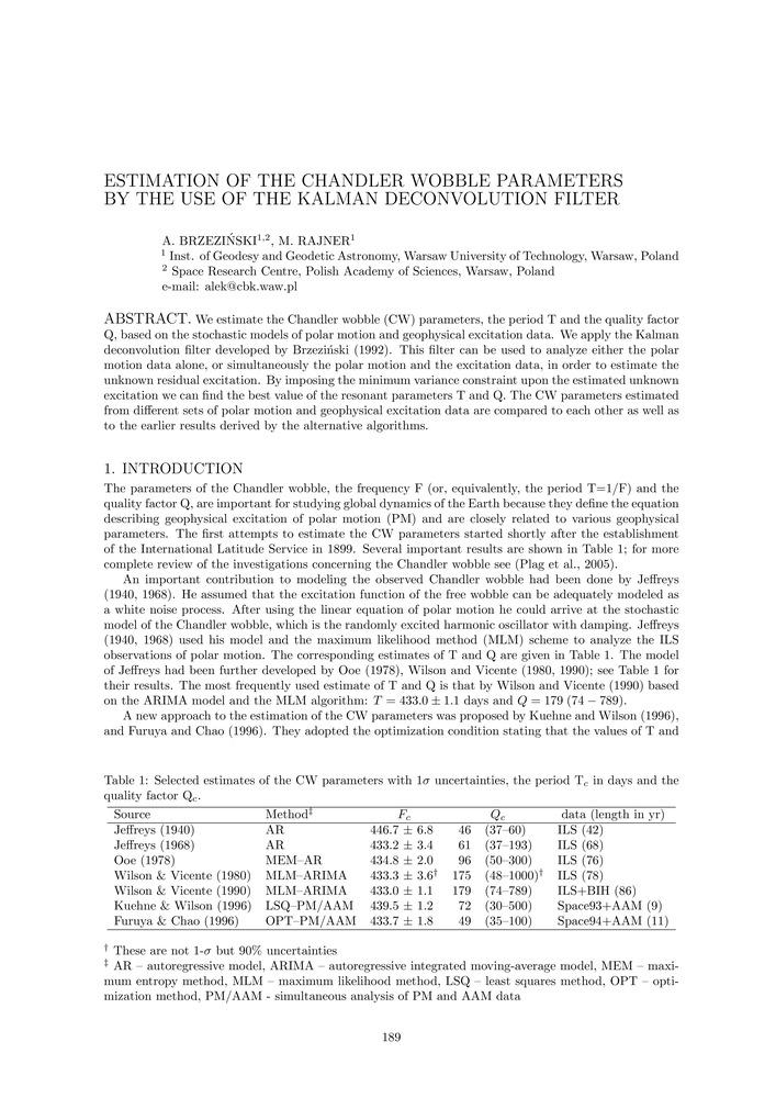
Brzeziński A. i M. Rajner. „Estimation of the Chandler wobble parameters by the use of the Kalman deconvolution filter”. Proceedings of the Journées 2013, Systèmes de Référence Spatio-Temporels, redaktor N. Capitaine, isbn 978-2-901057-69-7.
- [bib]
@inproceedings{Brzezinski2013_journee_proceedings,
}year = {2014}, author = {Brzeziński, Aleksander and Rajner, Marcin}, title = {Estimation of the Chandler wobble parameters by the use of the Kalman deconvolution filter}, booktitle = {Proceedings of the Journées 2013, Systèmes de Référence Spatio-Temporels}, editor = {Capitaine, N.}, isbn = {978-2-901057-69-7}, month = {dec}, - [.pdf]
- [url]
- [bib]
2012
-
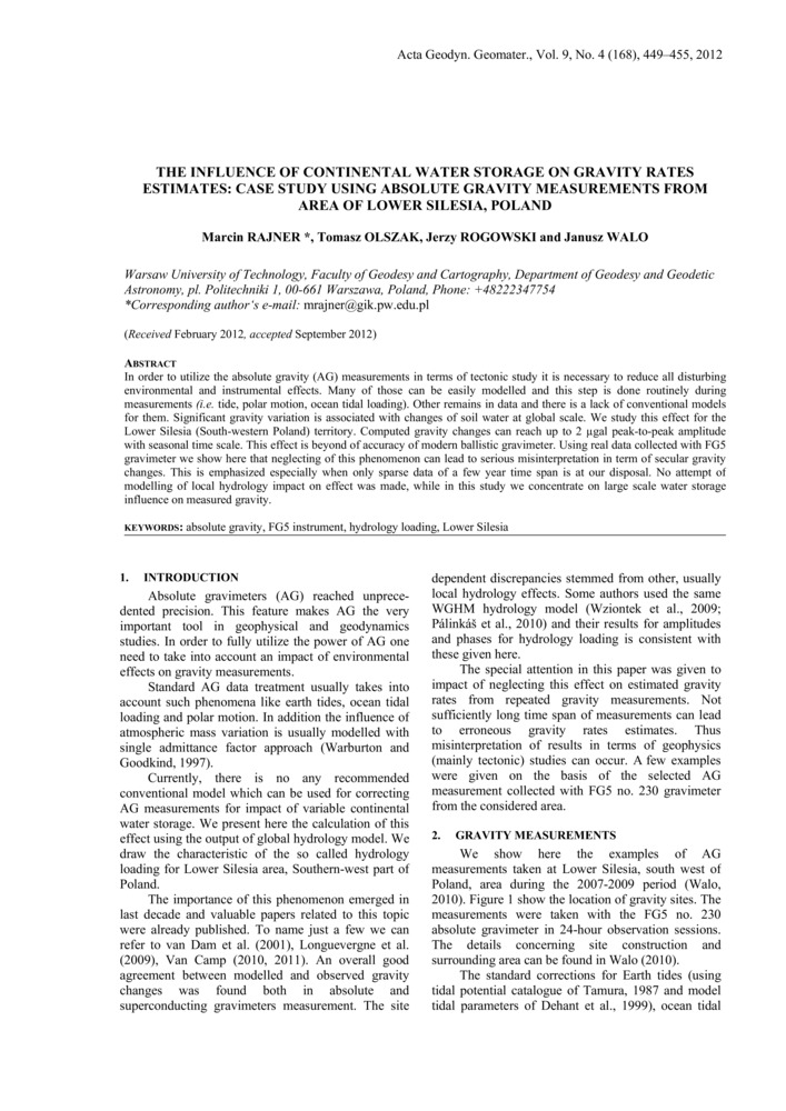
jcrRajner M., T. Olszak, J. B. Rogowski i J. Walo. „The influence of continental water storage on gravity rates estimates: case study using absolute gravity measurements from area of Lower Silesia, Poland”. Acta geodynamica et geomaterialia 9 (4/168): 449–55.
- [bib]
@article{Rajner2011jugowicepublikacja,
}volume = {9}, number = {4/168}, pages = {449-455}, author = {Rajner, Marcin and Olszak, Tomasz and Rogowski, Jerzy B. and Walo, Janusz}, year = {2012}, date = {2012-12-01}, month = {dec}, title = {The influence of continental water storage on gravity rates estimates: case study using absolute gravity measurements from area of Lower Silesia, Poland}, journal = {Acta geodynamica et geomaterialia}, - [streszczenie]
In order to utilize the absolute gravity (ag) measurements in terms of tectonic study it is necessary to reduce all disturbing environmental and instrumental effects. Many of those can be easily modelled and this step is done routinely during measurements (i.e. tide, polar motion, ocean tidal loading). Other remains in data and there is a lack of conventional models for them. Significant gravity variation is associated with changes of soil water at global scale. We study this effect for the Lower Silesia (South-western Poland) territory. Computed gravity changes can reach up to 2 µgal peak-to-peak amplitude with seasonal time scale. This effect is beyond of accuracy of modern ballistic gravimeter. Using real data collected with fg5 gravimeter we show here that neglecting of this phenomenon can lead to serious misinterpretation in term of secular gravity changes. This is emphasized especially when only sparse data of a few year time span is at our disposal. No attempt of modelling of local hydrology impact on effect was made, while in this study we concentrate on large scale water storage influence on measured gravity.
- [.pdf]
- [url]
- [bib]
-
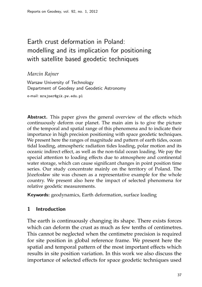
Rajner M. „Earth crust deformation in Poland: modelling and its implication for positioning with satellite based geodetic techniques”. Reports on Geodesy 92 (1): 37–46.
- [bib]
@article{Rajner12rog,
}author = {Rajner, Marcin}, title = {Earth crust deformation in Poland: modelling and its implication for positioning with satellite based geodetic techniques}, journal = {Reports on Geodesy}, year = {2012}, volume = {92}, number = {1}, pages = {37-46}, - [.pdf]
- [url]
- [bib]
2011
-
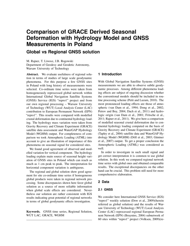
Rajner M., T. Liwosz i J. B. Rogowski. „Comparison of grace derived seasonal deformation with hydrology model and gnss measurements in Poland: global vs regional gnss solution”. Proceedings euref, redaktor A. Caporali. Kiszyniów, Mołdawia.
- [bib]
@inproceedings{RajnerLiwoszRogowskiproceedingseuref11,
}editor = {Caporali, A.}, author = {Rajner, Marcin and Liwosz, Tomasz and Rogowski, Jerzy B.}, year = {2011}, title = {Comparison of grace derived seasonal deformation with hydrology model and gnss measurements in Poland: global vs regional gnss solution}, booktitle = {Proceedings euref}, address = {Kiszyniów, Mołdawia}, eventdate = {2011-05-25/2011-05-28}, date = {2011-05-26}, month = {may}, - [.pdf]
- [url]
- [bib]
-
Rajner M. i J. B. Rogowski. „Earth free oscillation measurements with lcr-et26 spring gravimeter”. Reports on Geodesy 91 (2): 89–95.
- [bib]
@article{RajnerRogowski11b,
}author = {Rajner, Marcin and Rogowski, Jerzy B.}, title = {Earth free oscillation measurements with lcr-et26 spring gravimeter}, year = {2011}, journal = {Reports on Geodesy}, volume = {91}, number = {2}, pages = {89-95}, - [.pdf]
- [bib]
-
Rajner M. i T. Liwosz. „Studies of crustal deformation due to hydrological surface loading on gps height estimates”. Geodesy and Cartography 60 (2): 137–46.
- [bib]
@article{Rajner11a,
}author = {Rajner, Marcin and Liwosz, Tomasz}, title = {Studies of crustal deformation due to hydrological surface loading on gps height estimates}, year = {2011}, journal = {Geodesy and Cartography}, issn = {2080-6736}, volume = {60}, number = {2}, pages = {137-146}, doi = {10.2478/v10277-012-0012-y}, - [.pdf]
- [doi]
- [bib]
-
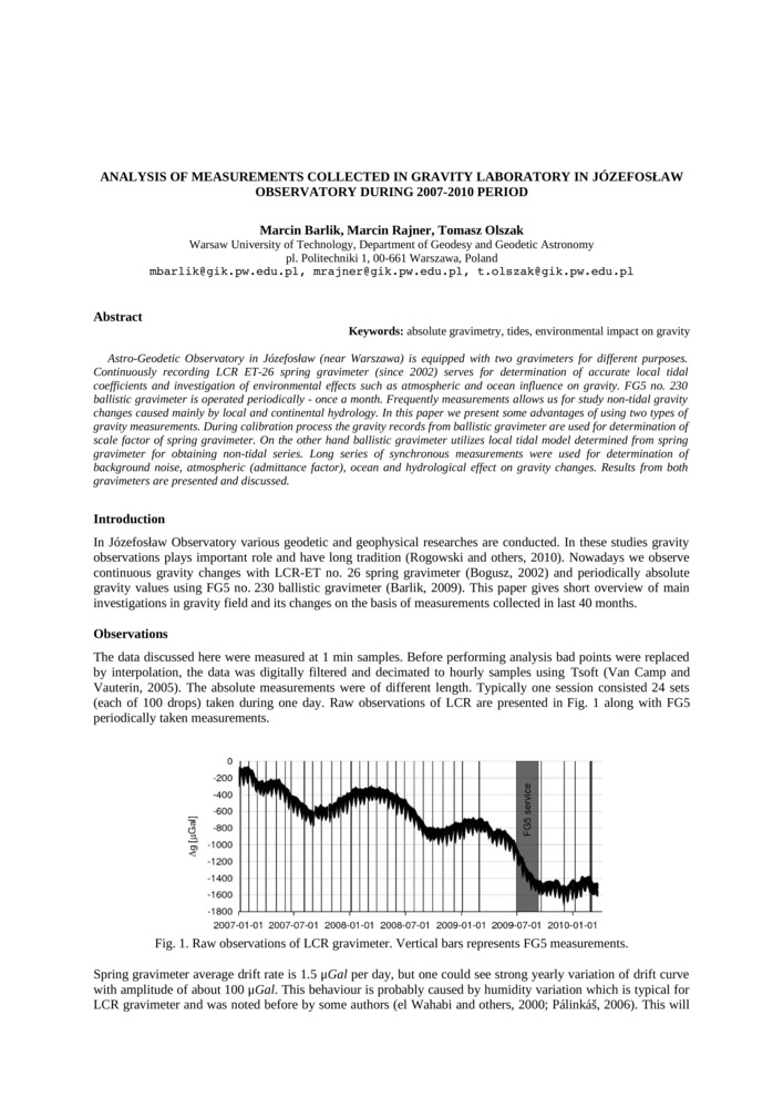
Barlik M., M. Rajner i T. Olszak. „Analysis of measurements collected in gravity laboratory in Józefosław observatory during 2007-2010”. Proceedings: iag Symposium on Terrestial Gravimetry, redaktor V. Peshekhonov, 116–20. Sankt Petersburg, Rosja.
- [bib]
@inproceedings{Barlik10e,
}author = {Barlik, Marcin and Rajner, Marcin and Olszak, Tomasz}, title = {Analysis of measurements collected in gravity laboratory in Józefosław observatory during 2007-2010}, booktitle = {Proceedings: iag Symposium on Terrestial Gravimetry}, address = {Sankt Petersburg, Rosja}, eventdate = {2010-06-22/2010-06-25}, year = {2011}, editor = {Peshekhonov, V.}, pages = {116-120}, - [streszczenie]
Astro-Geodetic Observatory in Józefosław (near Warszawa) is equipped with two gravimeters for different purposes. Continuously recording lcr et-26 spring gravimeter (since 2002) serves for determination accurate local tidal coefficients end investigation of environmental effect such as atmospheric and ocean influence on gravity. fg5 no. 230 ballistic gravimeter (since 2006) is operated periodically - once a month. Frequently measurements allows us for study non-tidal gravity changes caused mainly by hydrology. In this paper we present some advantages of using two types of gravity measurements. During calibration process the gravity records from ballistic gravimeter are used for determination of scale factor of spring gravimeter. On the other hand ballistic gravimeter utilize local tidal model determined from spring gravimeter for obtaining non-tidal series. Long series of synchronous measurements were used for determination of background noise, atmospheric (admittance factor), ocean and hydrological effect on gravity changes. The results from both gravimeters is presented and their agreement is discussed.
- [.pdf]
- [bib]
2010
-
Rajner M. „Ocean tidal loading from the gravity measurements at Józefosław observatory”. Artificial Satellites 45 (4): 175–83.
-
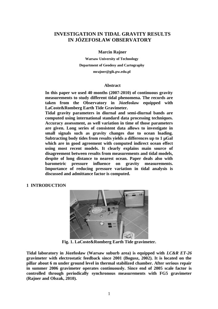
Rajner M. „Investigation in tidal gravity results in Józefosław observatory”. Reports on Geodesy 88 (1): 7–14.
- [bib]
- [streszczenie]
In this paper we used 40 months (2007-2010) of continuous gravity measurements to study different tidal phenomena. The records are taken from Observatory in Jozefoslaw equipped with LaCoste&Romberg Earth Tide Gravimeter.
Tidal gravity parameters in diurnal and semi-diurnal bands are computed using international standard data processing techniques. Accuracy assessment, as well variation in time of those parameters are given. Long series of consistent data allows to investigate in small signals such as gravity changes due to ocean loading. Subtracting body tides from results yields a differences up to 1 microGal which are in good common with computed indirect effect of ocean using most recent models. It clearly explains main source of disagreement between results from measurements and tidal models, despite of long distance to nearest ocean. Paper deals also with barometric pressure influence on gravity measurements. Importance of reducing pressure variation in tidal analysis is discussed and admittance factor is computed. - [.pdf]
-
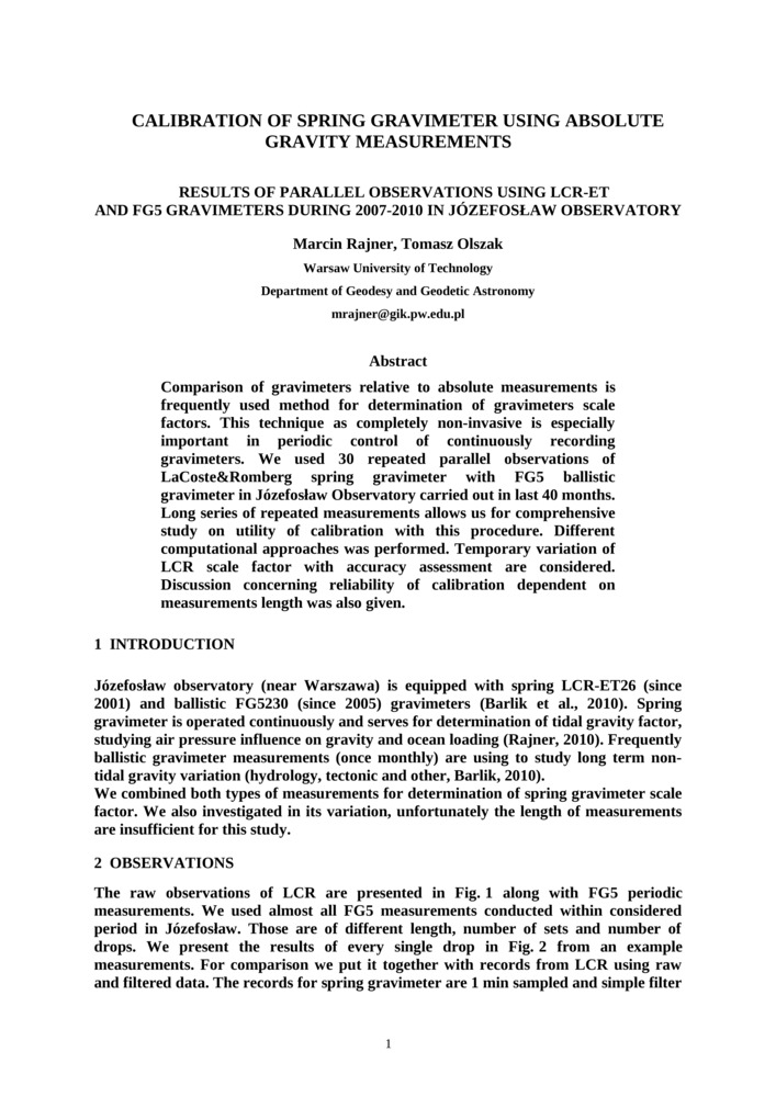
Rajner M. i T. Olszak. „Calibration of spring gravimeter using absolute gravity measurements. Results of parallel observations using lcr-et and fg5 gravimeters during 2007-2010 in Józefosław observatory”. Reports on Geodesy 88 (1): 15–20.
- [bib]
@article{Rajner10e,
}author = {Rajner, Marcin and Olszak, Tomasz}, title = {Calibration of spring gravimeter using absolute gravity measurements. Results of parallel observations using lcr-et and fg5 gravimeters during 2007-2010 in Józefosław observatory}, year = {2010}, volume = {88}, journal = {Reports on Geodesy}, number = {1}, pages = {15-20}, - [streszczenie]
Comparison of gravimeters relative to absolute measurements is frequently used method for determination of gravimeters scale factors. This technique as completely non-invasive is especially important in periodic control of continuously recording gravimeters. We used 30 repeated parallel observations of LaCoste&Romberg spring gravimeter with fg5 ballistic gravimeter in Jozefoslaw observatory carried out in last 40 months. Long series of repeated measurements allows us for comprehensive study on utility of calibration with this procedure. Different computational approaches was performed. Temporary variation of lcr scale factor with accuracy assessment are considered. Discussion concerning reliability of calibration dependent on measurements length was also given.
- [.pdf]
- [bib]
-
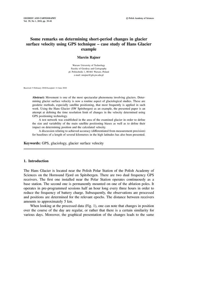
Rajner M. „Some remarks on determining short-period changes in glacier surface velocity using gps technique — case study of Hans glacier example”. Geodesy and Cartography 59 (1): 39–47.
- [bib]
@article{Rajner10d,
}author = {Rajner, Marcin}, title = {Some remarks on determining short-period changes in glacier surface velocity using gps technique — case study of Hans glacier example}, year = {2010}, journal = {Geodesy and Cartography}, volume = {59}, number = {1}, pages = {39-47}, doi = {10.2478/v10277-012-0007-8}, issn = {2080-6736}, - [streszczenie]
Movement is one of the most spectacular phenomena involving glaciers. Determining glacier surface velocity is now a routine aspect of glaciological studies. These are geodetic methods, especially satellite positioning, that most frequently is applied in such work. Using the Hans Glacier (sw Spitsbergen) as an example, the presented paper is an attempt at defining the time resolution limit of changes in the velocity determined using gps positioning technology. A test network was established in the area of the examined glacier in order to define the size and variability of the main satellite positioning biases as well as to define their impact on determining position and the calculated velocity. A discussion relating to achieved accuracy (differentiated from measurement precision) for baselines of a length of several kilometres in the high latitudes has also been presented.
Jednym z najciekawszych i najbardziej spektakularnych zjawisk dotyczących lodowców jest ich ruch. Wyznaczanie powierzchniowej prędkości lodowców jest obecnie czynnością rutynową w pracach glacjologicznych. Do tych celów stosuje się najczęściej metody geodezyjne, głównie pozycjonowanie satelitarne. W niniejszej pracy przedstawiono próbę określenia granicznej rozdzielczości czasowej przy wyznaczaniu krótkookresowych zmian prędkości z obserwacji gps na przykładzie lodowca Hansa na południowym Spitsbergenie. W tym celu została założona sieć pomiarowa, składająca się z jednego odbiornika na lodowcu oraz trzech odbiorników odniesienia w bezpośrednim sąsiedztwie lodowca. Na podstawie zebranych obserwacji zostały przedstawione rozważania dotyczące wpływu wybranych błędów pomiarowych technologii gps oraz ich wpływu na określanie sub-dobowych zmian prędkości na dużych szerokościach geograficznych. Błędy pomiarowe, mimo krótkich wektorów, głównie związane ze zmienną konfiguracją satelitów gps nie pozwoliły w tym przypadku na określanie zmian prędkości z rozdzielczością czasową większą niż doba. - [.pdf]
- [doi]
- [bib]
2006
-
Walo J., D. Puczko, A. Adamek, K. Węzka, Z. Malinowski i M. Rajner. „Monitoring of Hans Glacier movement dynamics (Hornsund sw Spitsbergen, Svalbard)”. Reports on Geodesy 76 (1): 173–79.
- [bib]
@article{Walo06a,
}author = {Walo, Janusz and Puczko, Dariusz and Adamek, Artur and Węzka, Kinga and Malinowski, Zbigniew and Rajner, Marcin}, title = {Monitoring of Hans Glacier movement dynamics (Hornsund sw Spitsbergen, Svalbard)}, journal = {Reports on Geodesy}, volume = {76}, number = {1}, year = {2006}, pages = {173-179}, - [.pdf]
- [bib]

2005
-
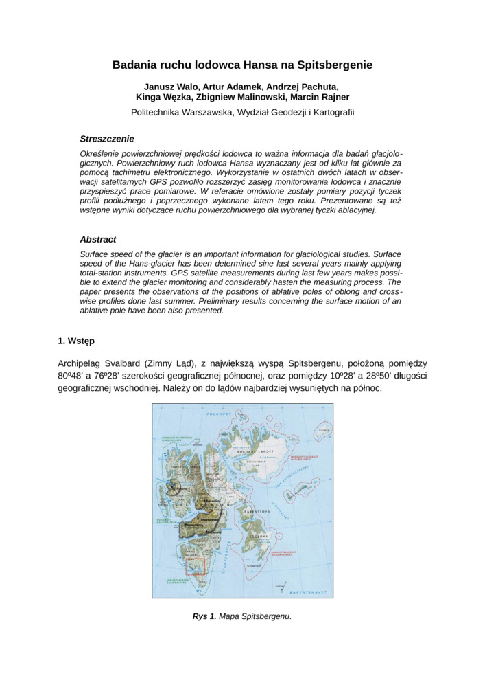
Walo J., A. Adamek, A. Pachuta, K. Węzka, Z. Malinowski i M. Rajner. „Badania ruchu lodowca Hansa na Spitsbergenie”. Geodetické siete a priestorové informácie. Podbanské, Słowacja.
- [bib]
@inproceedings{Walo05,
}author = {Walo, Janusz and Adamek, Artur and Pachuta, Andrzej and Węzka, Kinga and Malinowski, Zbigniew and Rajner, Marcin}, title = {Badania ruchu lodowca Hansa na Spitsbergenie}, eventtitle = {Geodetické siete a priestorové informácie}, address = {Podbanské, Słowacja}, eventdate = {2005-10-24/2005-10-26}, year = {2005}, - [.pdf]
- [bib]